- Devemos ter uma base sobre a interface do QGIS entendendo sobre as barras de menus e barras de ferramentas;
- Barra de menus: barra fixa que fica em cima que vai desde projeto até ajuda, ela apresenta opções de edição, camadas para adicionar arquivos, imagens de satélite, mapas, etc;
- Tipos de arquivos: vetoriais e raster (imagens ou matricial);
- Complementos: incorporar novas ferramentas ao QGIS;
- Barras de ferramentas: fica abaixo da barra de menus e pode ser deslocada para ficar à direita ou esquerda;
- Ferramentas ocultas: clica com botão direito do mouse sobre a barra de ferramentas para selecionar outras funções, devemos habilitar a função de "gerenciar camadas". Se habilitar todas as funções, a tela principal branca onde ficam os arquivos reduz, portanto, devemos habilitar apenas quando necessário;
- As principais ferramentas são as de gerenciar camadas (adição de camadas) e de navegação;
- Ao mover o mouse, são apresentadas as coordenadas na barra abaixo. Na barra inferior também estão as escalas do mapa, a lupa/zoom, rotação e o EPSG que apresenta o sistema de referência de coordenadas;
- Salvar projeto: na barra de menu aparece o nome "projeto sem título - QGIS", ao salvar o projeto indo em projeto -> salvar -> nome do projeto específico. Ao salvar o nome do projeto é alterado, após fechar o QGSI e abrir o projeto novamente, você é capaz de visualizar o trabalho de onde parou;
- Ao fazer novos processamentos no projeto, clica em "Salvar".
- Criar projeto: complementos -> gerenciar e instalar complementos -> na barra de busca clica em "Quickmap" -> QuickMapServices -> instalar complemento. O QuickMap services permite acessar dados de satélite de todo o mundo de diferentes bases de dados cartográficos.
Get the full scoop at NaturalEarthData.com
No, really! This readme is a poor substitute for the live site.
Natural Earth is a public domain map dataset available at 1:10m, 1:50m, and 1:110 million scales. Featuring tightly integrated vector (here) and raster data (over there), with Natural Earth you can make a variety of visually pleasing, well-crafted maps with cartography or GIS software.
Natural Earth was built through a collaboration of many volunteers and is supported by NACIS (North American Cartographic Information Society), and is free for use in any type of project (see our Terms of Use page for more information).
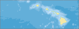
Natural Earth solves a problem: finding suitable data for making small-scale maps. In a time when the web is awash in geospatial data, cartographers are forced to waste time sifting through confusing tangles of poorly attributed data to make clean, legible maps. Because your time is valuable, Natural Earth data comes ready-to-use.

The carefully generalized linework maintains consistent, recognizable geographic shapes at 1:10m, 1:50m, and 1:110m scales. Natural Earth was built from the ground up so you will find that all data layers align precisely with one another. For example, where rivers and country borders are one and the same, the lines are coincident.
.svg.png)

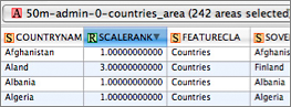
Natural Earth, however, is more than just a collection of pretty lines. The data attributes are equally important for mapmaking. Most data contain embedded feature names, which are ranked by relative importance. Other attributes facilitate faster map production, such as width attributes assigned to river segments for creating tapers.
The 2.0 release in 2012 marked the project's shift from so-called marketing versions to semantic versioning.
Natural Earth is a big project with hundreds of files that depend on each other and the total weighs in at several gigabytes. SemVer is a simple set of rules and requirements around version numbers. For our project, the data layout is the API.
- Version format of X.Y.Z (Major.Minor.Patch).
- Backwards incompatible changes, increment the major version X.
- Backwards compatible additions/changes, increment the minor version Y
- Bug fixes not affecting the file and field names, patch version Z will be incremented.
Major version increments:
- Changing existing data file names
- Changing existing data column (field) names
- Removing
FeatureClafield attribute values - Additions, deletions to admin-0
- Introduce significant new themes
Minor version increments:
- Any shape or attribute change in admin-0
- Additions, deletions, and any shape or attribute changes in admin-1
- Additions, deletions to any theme
- Major shape or attribute changes in any theme
- Adding, changing
FeatureClafield attribute values - Introduce minor new themes
Patch version increments:
- Minor shape or attribute changes in any theme
- Bug fixes to shape, attributes in any theme
Under this scheme, version numbers and the way they change convey meaning about the underlying code and what has been modified from one version to the next.
When we introduce a new version of Natural Earth, you can tell by the version number how much effort you will need to extend to integrate the data with your map implementation.
- Bug fixes Z: can simply use the new data files, replacing your old files.
- Minor version Y: limited integration challenges.
- Major version X: significatnt integration challenges, either around changed file strucutre, field layout, field values like
FeatureClaused in symbolizing data, or significant new additions or significant changes to existing themes.
Natural Earth is maintained by Nathaneiel V. KELSO (@nvkelso) and Tom Patterson.
The project transitioned to Github in 2012. Versioned files are here to collaborate around. The frontend still lives at NaturalEarthData.com.